Erkennung und Kartierung von Altlasten mit Drohne
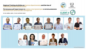
Die Erkennung und Kartierung von Altlasten wie Uran aus der Luft mit Drohne ist eine große Herausforderung und erfordert zumeist eine Spezial-Entwicklung. Wir freuen uns von Anbeginn in einem internationalen Projekt der IAEA mitwirken zu dürfen. In der Ersten SetUp-Phase des Projektes und bei der Ausbildung der Piloten aus Zentralasien auf Basis für den Kompetenznachweis der EU und die Prüfungsvorbereitung für den Prüfung beim LBA hat CopterCloud aktiv mitgewirkt. Für die Detektion radioaktiver Strahlung mit einem Gammaspektrometer in Kasachstan, Tadschikistan und Usbekistan wurde in einem Forschungsprojekt des BMBF ein Spezialdrohne entwickelt.
Auf der Internsetseite der IAEA ist zu diesem Projekt für die Kartierung und Erkennung von Altlasten aus der Luft mit Drohne ein Artikel erschienen:
IAEA Harnesses Drone Technology to support Safer Environmental Remediation in Central Asia
An emerging technology combining a drone with a highly sensitive gamma-ray detector will be deployed in coming months to monitor radiation at contaminated uranium legacy sites in Central Asia. These sites are former uranium mining and processing areas in Kazakhstan, Kyrgyzstan, Tajikistan and Uzbekistan and this advanced drone technology will support the safe and secure monitoring of radiation levels at these sites.
“Uranium mining and processing in this region between the 1940s and 1990s has left behind a number of radioactively contaminated uranium legacy sites,” said Sven Altfelder, an IAEA remediation safety specialist, adding that ‘experts in Central Asia monitor these sites for radioactivity on foot, wearing backpacks equipped with gamma-ray spectrometers that detect the presence of natural radionuclides, including uranium.” As most of the uranium legacy sites lie in difficult-to-reach mountainous and seismically active areas, monitoring with backpacks is challenging and less efficient, he said…… Lesen Sie hier den kompletten Artikel
Experten-Team DUB GEM